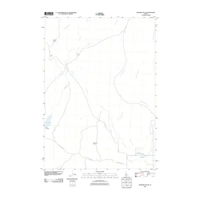
2010 Map of McKinney Butte
USGS Topo · Published 2010About this map
McKinney Butte rises above a landscape defined by an intricate network of desert drainages and modern irrigation infrastructure in Gooding County. This 2010 survey highlights the intersection of natural watercourses like Cottonwood Creek and Fourmile Creek with man-made developments such as the North Gooding Main Canal and Robertson Ditch. Remote outposts and historic extraction sites are scattered throughout the territory, including the Hole-in-The-Wall Cabin and a Chalk Mine located near the western edge of the quadrangle. The presence of Bray Lake and its associated Bray Lake Dam illustrates the importance of water management in this arid region, while the Bostrum Canal further marks the engineering efforts to divert flow across the plains. Other notable features like the Crist Cabin and the winding path of Dry Creek provide specific landmarks for those tracing the history of land use and seasonal ranching in the Idaho desert.
Find a feature on this map
20 named features on this map. Tap any name to fly to it.
Don’t see what you’re looking for? This feature index may not catch every label — zoom into the map to look around manually.
Map Details
Editions of this 2010 McKinney Butte Map
This is the sole edition of this map. No revisions or reprints were ever made.
Other maps of this area

1949 · Bliss
USGS Topo · 1:24,000

1949 · Gooding Butte
USGS Topo · 1:24,000

1950 · Gooding Butte
USGS Topo · 1:24,000

1950 · Bliss
USGS Topo · 1:24,000

1955 · Twin Falls
USGS Topo · 1:250,000

1955 · Hailey
USGS Topo · 1:250,000

1957 · Thorn Creek SW
USGS Topo · 1:24,000

1957 · Thorn Creek
USGS Topo · 1:62,500

1957 · Davis Mountain
USGS Topo · 1:62,500

1958 · Twin Falls
USGS Topo · 1:250,000