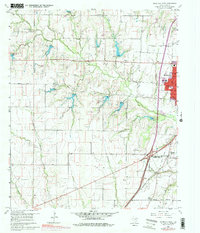
1960 Map of McKinney West
USGS Topo · Published 1978About this map
McKinney and the surrounding North Texas blackland prairie are shown during a period of transition as the town expands westward. This map captures the edge of urban growth marked by purple photo-revisions, contrasting the established downtown and its High Sch with rural family landmarks. The landscape is defined by the headwaters of several drainages, including Wilson Creek, Rowlett Creek, and Sloan Creek, where small-scale gravel operations like the Gravel Pits are active. Historically significant sites such as the Buckner (Site) and numerous family burial grounds including Ware Cem, Hunt Cem, and Stimpson Cem offer essential points of reference for genealogists. The Southern Pacific railroad corridor and local thoroughfares like Rockhill Road and Bois D'Arc Road illustrate the connectivity between early settlements like Bloomdale and the growing residential areas near Fairview.
Find a feature on this map
31 named features on this map. Tap any name to fly to it.
Don’t see what you’re looking for? This feature index may not catch every label — zoom into the map to look around manually.
Map Details
Editions of this 1960 McKinney West Map
4 editions found
Other maps of this area

1924 · Mc Kinney 4-d
USGS Topo · 1:48,000

1929 · Frisco
USGS Topo · 1:62,500

1929 · McKinney
USGS Topo · 1:62,500

1954 · Sherman
USGS Topo · 1:250,000

1958 · Sherman
USGS Topo · 1:250,000

1959 · Wylie
USGS Topo · 1:24,000

1960 · Frisco
USGS Topo · 1:24,000

1960 · McKinney East
USGS Topo · 1:24,000

1960 · Celina
USGS Topo · 1:24,000

1960 · Plano
USGS Topo · 1:24,000