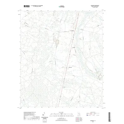
2020 Map of McKinnon
USGS Topo · Published 2020About this map
Penholoway Creek and its many tributaries, including Little Penholoway Creek and Bear Branch, dominate the landscape of Wayne County in this recent survey. The settlement pattern follows a linear corridor along Pine Street, which connects the small communities of Broadhurst, Sun Hill, McKinnon, and O Neal. These rural nodes are surrounded by a complex network of wetlands and wooded terrain, most notably the Cypress Swamp and Piney Bay.
Find a feature on this map
39 named features on this map. Tap any name to fly to it.
Don’t see what you’re looking for? This feature index may not catch every label — zoom into the map to look around manually.
Map Details
Editions of this 2020 McKinnon Map
This is the sole edition of this map. No revisions or reprints were ever made.
Other maps of this area

1918 · Jesup
USGS Topo · 1:62,500

1918 · Hortense
USGS Topo · 1:62,500

1943 · Jesup
USGS Topo · 1:62,500

1944 · Hortense
USGS Topo · 1:62,500

1946 · Brunswick
USGS Topo · 1:250,000

1948 · Brunswick
USGS Topo · 1:250,000

1953 · Waycross
USGS Topo · 1:250,000

1956 · Brunswick
USGS Topo · 1:250,000

1958 · Waycross
USGS Topo · 1:250,000

1961 · Brunswick
USGS Topo · 1:250,000