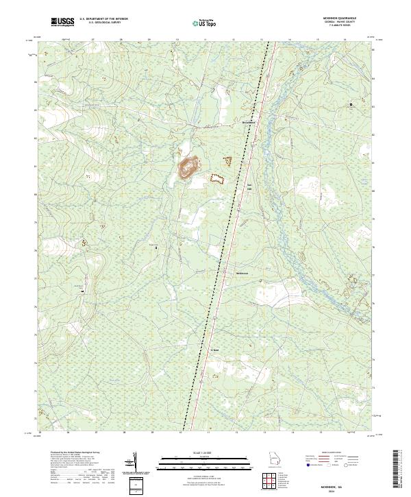
2024 Map of McKinnon
USGS Topo · Published 2024About this map
Broadhurst and Sun Hill anchor this corner of Wayne County, where the landscape is defined by the winding course of Little Penholoway Creek and its many tributaries. The area maintains a rural, low-lying character with significant wetlands like Cypress Swamp and the Duck Pond. For those researching family history, the map preserves the locations of several burial grounds, including the Old German Cem, Rogers Cem, and Duck Pond Cem. The road network, including Old Hortense Rd and Rogers Cemetery Rd, connects small communities like McKinnon and O Neal through a terrain of pine forests and blackwater creeks. The presence of a Gravel Pit near Bear Branch points to the local extraction industry that shapes this coastal plain geography.
Find a feature on this map
39 named features on this map. Tap any name to fly to it.
Don’t see what you’re looking for? This feature index may not catch every label — zoom into the map to look around manually.
Map Details
Editions of this 2024 McKinnon Map
This is the sole edition of this map. No revisions or reprints were ever made.
Other maps of this area

1918 · Jesup
USGS Topo · 1:62,500

1918 · Hortense
USGS Topo · 1:62,500

1943 · Jesup
USGS Topo · 1:62,500

1944 · Hortense
USGS Topo · 1:62,500

1946 · Brunswick
USGS Topo · 1:250,000

1948 · Brunswick
USGS Topo · 1:250,000

1953 · Waycross
USGS Topo · 1:250,000

1956 · Brunswick
USGS Topo · 1:250,000

1958 · Waycross
USGS Topo · 1:250,000

1961 · Brunswick
USGS Topo · 1:250,000