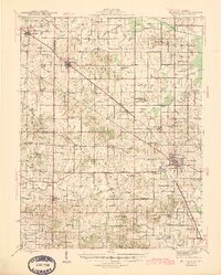
1945 Map of McLeansboro
USGS Topo · Published 1945About this map
Mc Leansboro serves as the hub of this Southern Illinois landscape during the mid-1940s, situated at the intersection of a dense network of country schools and rural churches. The Louisville and Nashville railroad cuts diagonally across the quadrangle, passing through Dahlgren and Delafield, illustrating the rail-dependent economy of the era. The terrain is defined by the drainages of the Middle Fork Muddy River and Tenmile Creek, which create a rolling patchwork of named prairies like Knight Prairie and Parkers Prairie. For researchers, the map provides an exacting record of local genealogy through scattered landmarks such as Marys Chapel, Piopolis, and the Union Hill Cem. This 1945 edition shows a community still largely organized around its township schools, with dozens of facilities like Anderson Sch and Sutton Sch dotting the countryside before the post-war trend of school consolidation.
Find a feature on this map
91 named features on this map. Tap any name to fly to it.
Don’t see what you’re looking for? This feature index may not catch every label — zoom into the map to look around manually.
Map Details
Editions of this 1945 McLeansboro Map
2 editions found

Other maps of this area

1905 · Eldorado
USGS Topo · 1:62,500

1906 · Eldorado
USGS Topo · 1:62,500

1908 · Galatia
USGS Topo · 1:62,500

1909 · West Frankfort
USGS Topo · 1:62,500

1933 · Mount Vernon
USGS Topo · 1:48,000

1938 · Galatia
USGS Topo · 1:62,500

1939 · Ina
USGS Topo · 1:62,500

1940 · Mount Vernon
USGS Topo · 1:62,500

1941 · West Frankfort
USGS Topo · 1:62,500

1941 · Enfield
USGS Topo · 1:62,500