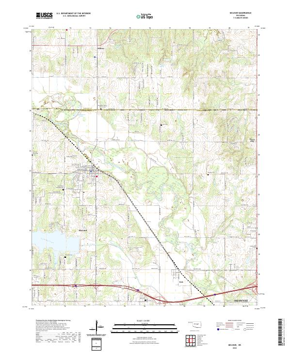
2022 Map of McLoud
USGS Topo · Published 2022About this map
The North Canadian River meanders across this landscape south of the Lincoln Co Pottawatomie Co line, anchoring a region defined by small rural settlements and numerous historic burial sites. The town of McLoud is the primary population center, supported by outlying communities such as Midway, Dale, and Centerville. Genealogists will find a high concentration of established cemeteries, including the Kickapoo Friends Church Cem, Saint Johns Lutheran Cem, and the McLoud Riverside Cem near the riverbanks. The terrain is marked by water features like Kishketon Lake and the Hidden Valley area, while the southern edge of the map begins to transition into the northern reaches of Shawnee. A network of section-line roads and named drives like Happy Trails Dr provides access to the interior wetlands and springs including Bullard Spring and Chager Spring.
Find a feature on this map
122 named features on this map. Tap any name to fly to it.
Don’t see what you’re looking for? This feature index may not catch every label — zoom into the map to look around manually.
Map Details
Editions of this 2022 McLoud Map
This is the sole edition of this map. No revisions or reprints were ever made.
Other maps of this area

1896 · Seminole and Prague
USGS Topo · 1:125,000

1898 · Purcell
USGS Topo · 1:125,000

1905 · Chandler
USGS Topo · 1:62,500

1907 · Chandler
USGS Topo · 1:62,500

1909 · Shawnee
USGS Topo · 1:62,500

1909 · Luther
USGS Topo · 1:62,500

1930 · McLoud
USGS Topo · 1:62,500

1954 · Oklahoma City
USGS Topo · 1:250,000

1956 · Harrah
USGS Topo · 1:24,000

1956 · Horseshoe Lake
USGS Topo · 1:24,000