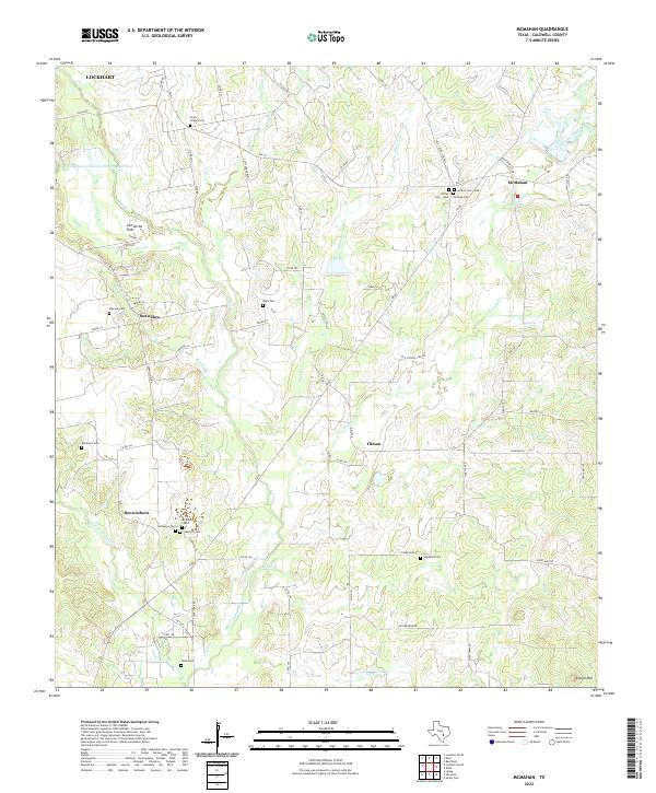
2022 Map of McMahan
USGS Topo · Published 2022About this map
The small communities of McMahan, Seawillow, Tilmon, and Brownsboro dot the landscape of Caldwell County, where cattle ranching and farming have long defined the character of the terrain. This area is heavily influenced by the drainage patterns of Plum Creek and its many tributaries, including Tenney Creek and Daniels Cr. A significant concentration of family and community burial sites, such as Clark Chapel Cem, Hardshell Cem, and the dual Jeffrey Cem - West and Jeffrey Cem - East, provides a detailed record of local genealogy and early settlement patterns.
Find a feature on this map
71 named features on this map. Tap any name to fly to it.
Don’t see what you’re looking for? This feature index may not catch every label — zoom into the map to look around manually.
Map Details
Editions of this 2022 McMahan Map
This is the sole edition of this map. No revisions or reprints were ever made.
Other maps of this area

1901 · Flatonia
USGS Topo · 1:125,000

1911 · San Marcos
USGS Topo · 1:125,000

1919 · San Marcos
USGS Topo · 1:125,000

1925 · San Marcos 1-d
USGS Topo · 1:48,000

1925 · San Marcos 4-a
USGS Topo · 1:48,000

1929 · Luling
USGS Topo · 1:62,500

1930 · Lockhart
USGS Topo · 1:62,500

1953 · Seguin
USGS Topo · 1:250,000

1958 · Seguin
USGS Topo · 1:250,000

1963 · Lockhart North
USGS Topo · 1:24,000