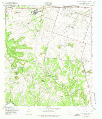
1958 Map of McMillan Mountains
USGS Topo · Published 1974About this map
Fort Hood Military Reservation dominates this central Texas landscape, where the boundary between Coryell and Bell counties crosses through the high ground of Crossville Mountain and McMillan Mountains. The terrain is defined by the sharp escarpments of Sevenmile Mountain and the winding course of the Lampasas River in the south, which draws tributaries like Sycamore Branch and Gann Branch from the surrounding ridges.
Find a feature on this map
33 named features on this map. Tap any name to fly to it.
Don’t see what you’re looking for? This feature index may not catch every label — zoom into the map to look around manually.
Map Details
Editions of this 1958 McMillan Mountains Map
3 editions found
Other maps of this area

1893 · Georgetown
USGS Topo · 1:125,000

1894 · Gatesville
USGS Topo · 1:125,000

1930 · Killeen
USGS Topo · 1:62,500

1947 · Fort Hood
USGS Topo · 1:62,500

1947 · Fort Hood
USGS Topo · 1:24,000

1947 · Post Oak Mountain
USGS Topo · 1:24,000

1947 · Killeen
USGS Topo · 1:62,500

1947 · McMillan Mountains
USGS Topo · 1:24,000

1947 · Killeen
USGS Topo · 1:24,000

1947 · Twin Moutains
USGS Topo · 1:24,000