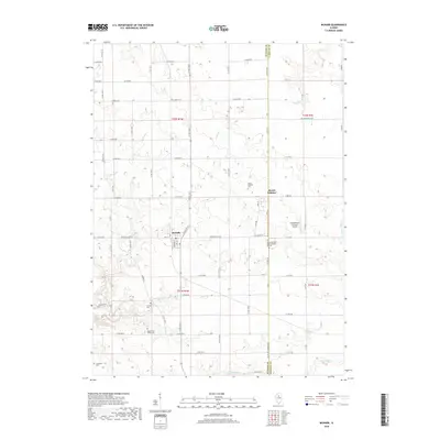
2018 Map of McNabb
USGS Topo · Published 2018About this map
McNabb sits at the heart of this agricultural landscape in north-central Illinois, serving as a primary hub where the McNabb Blacktop and Main St converge. The area is defined by a dense network of country roads and several family and community burial grounds, including the Mount Palatine Cem and the Boyle-Price Valley Cem, which offer significant touchpoints for genealogical research. To the east, the settlement of Mount Palatine borders the Putnam and LaSalle County line, reflecting the long-standing political boundaries that shaped local administration. The terrain is dissected by numerous waterways such as Cedar Cr and Clear Cr, while the presence of the Hartenbower Hectares Airport highlights the integration of modern small-scale aviation into this traditional farming region.
Find a feature on this map
42 named features on this map. Tap any name to fly to it.
Don’t see what you’re looking for? This feature index may not catch every label — zoom into the map to look around manually.
Map Details
Editions of this 2018 McNabb Map
This is the sole edition of this map. No revisions or reprints were ever made.
Other maps of this area

1893 · Lacon
USGS Topo · 1:62,500

1893 · Hennepin
USGS Topo · 1:62,500

1893 · Lasalle
USGS Topo · 1:62,500

1909 · Hennepin
USGS Topo · 1:62,500

1911 · La Salle
USGS Topo · 1:62,500

1911 · Hennepin
USGS Topo · 1:62,500

1913 · La Salle
USGS Topo · 1:62,500

1933 · Lacon
USGS Topo · 1:62,500

1934 · Wenona
USGS Topo · 1:48,000

1937 · Lacon
USGS Topo · 1:62,500