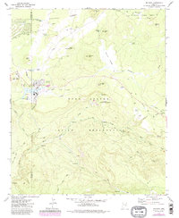
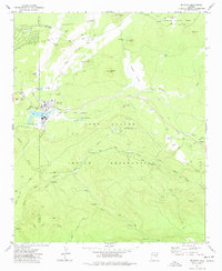
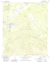
1977 Map of McNary
USGS Topo · Published 1985About this map
McNary serves as the central hub of this mid-century survey, straddling the border of Sitgreaves National Forest and the Fort Apache Indian Reservation. The settlement pattern is defined by the timber and utility infrastructure of the era, featuring a Substation, Water Tank, and numerous Campground sites spread across the high country. An Old Railroad Grade and the McNary Vernon Road provide a look at the industrial and transport arteries that once linked these mountain outposts to the broader region.
Find a feature on this map
45 named features on this map. Tap any name to fly to it.
Don’t see what you’re looking for? This feature index may not catch every label — zoom into the map to look around manually.
Map Details
Editions of this 1977 McNary Map
3 editions found
Other maps of this area

1886 · St Johns
USGS Topo · 1:250,000

1892 · St Johns
USGS Topo · 1:250,000

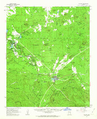
1954 · Clifton
USGS Topo · 1:250,000

1954 · Saint Johns
USGS Topo · 1:250,000

1957 · Clifton
USGS Topo · 1:250,000

1957 · Saint Johns
USGS Topo · 1:250,000

1958 · Clifton
USGS Topo · 1:250,000

1958 · Saint Johns
USGS Topo · 1:250,000
1961 · McNary
USGS Topo · 1:62,500

1962 · Clifton
USGS Topo · 1:250,000