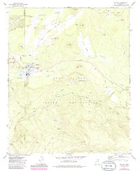
1977 Map of McNary
USGS Topo · Published 1986About this map
McNary sits at the high-elevation junction of the Sitgreaves National Forest and the Fort Apache Indian Reservation, serving as a focal point for timber and water resources in this part of Arizona. The settlement is clearly defined by its industrial and community infrastructure, featuring an Athletic Field, Substation, and proximity to several Cinder Pit locations. The landscape is crisscrossed by an extensive network of Old Railroad Grade and various timber-access routes like the Upper Log Road and Lower Log Road, indicating a history shaped by logging operations.
Find a feature on this map
45 named features on this map. Tap any name to fly to it.
Don’t see what you’re looking for? This feature index may not catch every label — zoom into the map to look around manually.
Map Details
Editions of this 1977 McNary Map
3 editions found
Other maps of this area

1886 · St Johns
USGS Topo · 1:250,000

1892 · St Johns
USGS Topo · 1:250,000

1954 · Clifton
USGS Topo · 1:250,000

1954 · Saint Johns
USGS Topo · 1:250,000

1957 · Clifton
USGS Topo · 1:250,000

1957 · Saint Johns
USGS Topo · 1:250,000

1958 · Clifton
USGS Topo · 1:250,000

1958 · Saint Johns
USGS Topo · 1:250,000

1961 · McNary
USGS Topo · 1:62,500

1962 · Clifton
USGS Topo · 1:250,000