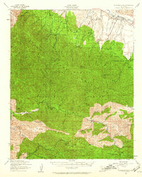
1941 Map of McPherson Peak
USGS Topo · Published 1961About this map
McPherson Peak and the high ridges of the Los Padres National Forest dominate this 1941 landscape, where the boundary between San Luis Obispo and Santa Barbara counties follows the winding course of the Cuyama River. The map captures a transition from the agricultural operations of the Hinsdale Ranch and Grey Ranch in the north toward the protected wilderness of the San Rafael Primitive Area. The interior is marked by cattle-country features like the Montgomery Potrero and the distinctive geological formation known as Hurricane Deck. Cultural footprints of the era are visible at the Wasioja Sch and the White Oaks Guard Station, alongside scattered water sources like Hog Pen Spring and Dripping Spring that sustained early ranching and forestry efforts in this isolated part of the California coast ranges.
Find a feature on this map
35 named features on this map. Tap any name to fly to it.
Don’t see what you’re looking for? This feature index may not catch every label — zoom into the map to look around manually.
Map Details
Editions of this 1941 McPherson Peak Map
3 editions found
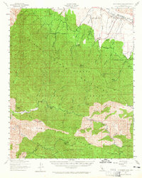
Other maps of this area

1902 · Santa Ynez
USGS Topo · 1:125,000

1905 · Santa Ynez
USGS Topo · 1:125,000

1905 · Lompoc
USGS Topo · 1:125,000

1912 · McKittrick
USGS Topo · 1:125,000

1937 · Branch Mtn
USGS Topo · 1:48,000

1941 · San Rafael Mtn.
USGS Topo · 1:62,500

1941 · Caliente Mountain
USGS Topo · 1:62,500

1941 · McPherson Peak
USGS Topo · 1:62,500

1942 · Lompoc
USGS Topo · 1:125,000

1942 · Branch Mountain
USGS Topo · 1:62,500