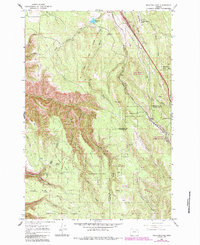
1963 Map of Meacham Lake
USGS Topo · Published 1984About this map
The Union Pacific Railroad carves a steep path through this mountain pass, following the historic corridor of the Old Oregon Trail. This 1963 survey shows a landscape where industrial infrastructure and wilderness intersect, featuring a Landing Strip, an Airway Beacon, and a U.S. Weather Bureau Station situated along the high ridges. The settlements of Meacham and Kamela anchor the rail line, while the surrounding timberlands are divided among the Umatilla National Forest and the Wallowa Whitman National Forest.
Find a feature on this map
44 named features on this map. Tap any name to fly to it.
Don’t see what you’re looking for? This feature index may not catch every label — zoom into the map to look around manually.
Map Details
Editions of this 1963 Meacham Lake Map
2 editions found
Other maps of this area

1935 · Pendleton
USGS Topo · 1:125,000

1953 · Pendleton
USGS Topo · 1:250,000

1956 · Pendleton
USGS Topo · 1:250,000

1963 · Meacham Lake
USGS Topo · 1:24,000

1964 · Mc Intyre Creek
USGS Topo · 1:24,000

1964 · Duncan
USGS Topo · 1:24,000

1964 · Huron
USGS Topo · 1:24,000

1964 · Meacham
USGS Topo · 1:24,000

1964 · Kamela SE
USGS Topo · 1:24,000

1966 · Cabbage Hill
USGS Topo · 1:24,000