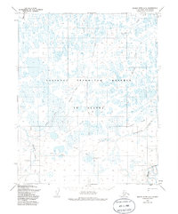
1955 Map of Meade River A-3
USGS Topo · Published 1986About this map
The National Petroleum Reserve in Alaska is the setting for this mid-century topographic record, capturing a landscape defined by seasonal movement and early mineral exploration. The area is dominated by the winding course of the Meade River and a complex network of coastal plain tributaries, including Pikroka Creek and Pisiksagiavik Creek. An interpretive highlight is the presence of Meade Test Well No 1, a drill hole that signifies the era's focus on identifying energy resources in the far north. Surface travel is largely restricted to the network of Winter Trails that crisscross the tundra, connecting the drainage basins of Kowlak Creek and Agutiroak Creek. This survey reflects the specialized infrastructure of the North Slope borough before more permanent modern developments, focused on scientific and industrial appraisal of the Arctic environment.
Find a feature on this map
10 named features on this map. Tap any name to fly to it.
Don’t see what you’re looking for? This feature index may not catch every label — zoom into the map to look around manually.
Map Details
Editions of this 1955 Meade River A-3 Map
2 editions found
Other maps of this area

1951 · Meade River
USGS Topo · 1:250,000

1951 · Lookout Ridge
USGS Topo · 1:250,000

1955 · Meade River
USGS Topo · 1:250,000

1955 · Meade River A-3
USGS Topo · 1:63,360

1955 · Meade River B-3
USGS Topo · 1:63,360

1955 · Meade River A-2
USGS Topo · 1:63,360
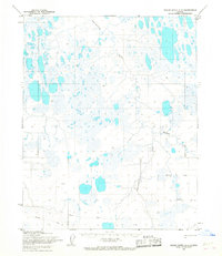
1955 · Meade River A-4
USGS Topo · 1:63,360

1955 · Meade River B-2
USGS Topo · 1:63,360

1955 · Meade River B-4
USGS Topo · 1:63,360

1956 · Lookout Ridge
USGS Topo · 1:250,000