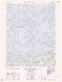
1962 Map of Meade River D-5
USGS Topo · Published 1962About this map
Peard Bay dominates this coastal survey, where the icy waters of the Chukchi Sea meet the northern reaches of the Alaskan tundra. Compiled by the Army Map Service using 1950s photogrammetric methods, the map documents a transition point between maritime navigation and terrestrial exploration. The shoreline is defined by the narrow spit extending to Point Franklin and the scattered Seahorse Islands, highlighting the precarious nature of the Arctic coast. Inland, the map covers a portion of the Naval Petroleum Reserve No 4, reflecting the strategic industrial interest in the region's resources during the mid-20th century. Hydrographic data includes numerous sightings of possible shoals and depth soundings in fathoms, essential for vessels navigating these shallow, shifting coastal waters near Nalmiu Point. A lone Tower serves as one of the few terrestrial landmarks in this sparsely settled landscape.
Find a feature on this map
9 named features on this map. Tap any name to fly to it.
Don’t see what you’re looking for? This feature index may not catch every label — zoom into the map to look around manually.
Map Details
Editions of this 1962 Meade River D-5 Map
This is the sole edition of this map. No revisions or reprints were ever made.
Other maps of this area

1951 · Meade River
USGS Topo · 1:250,000

1951 · Wainwright
USGS Topo · 1:250,000

1955 · Wainwright
USGS Topo · 1:250,000

1955 · Meade River
USGS Topo · 1:250,000

1955 · Wainwright C-1
USGS Topo · 1:63,360

1955 · Meade River D-5
USGS Topo · 1:63,360

1955 · Meade River C-5
USGS Topo · 1:63,360
1955 · Meade River D-4
USGS Topo · 1:63,360

1955 · Meade River C-4
USGS Topo · 1:63,360
1955 · Wainwright D-1
USGS Topo · 1:63,360