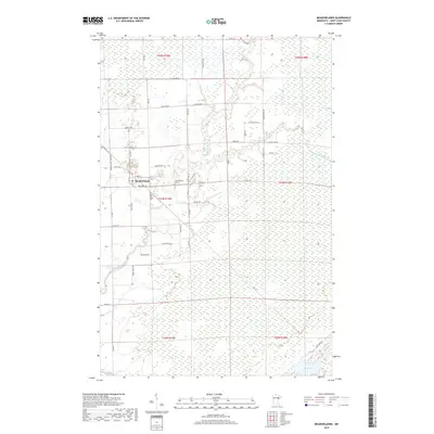
2019 Map of Meadowlands
USGS Topo · Published 2019About this map
Meadowlands serves as the primary hub of this northern landscape, where the Whiteface River and its tributary, the Little Whiteface River, wind through a vast network of wetlands and forested tracts. This 2019 survey illustrates the persistent rural character of Saint Louis County, defined by a grid of township roads such as Watsula Rd and Davidson Rd that cut through the low-lying terrain. The town itself is centered near the intersection of HWY 133 and HWY 29, with the Meadowlands Cem located just to the east. The southern reaches of the map show a shift toward open water at Aerie Lake, providing a contrast to the dense river-valley vegetation. This map captures a modern view of a region where the legacy of early 20th-century drainage and settlement patterns continues to shape the community's relationship with the surrounding wilderness.
Find a feature on this map
49 named features on this map. Tap any name to fly to it.
Don’t see what you’re looking for? This feature index may not catch every label — zoom into the map to look around manually.
Map Details
Editions of this 2019 Meadowlands Map
This is the sole edition of this map. No revisions or reprints were ever made.
Other maps of this area

1953 · Payne
USGS Topo · 1:24,000

1953 · Alborn
USGS Topo · 1:24,000

1953 · Brookston NW
USGS Topo · 1:24,000

1953 · Duluth
USGS Topo · 1:250,000

1954 · Hibbing
USGS Topo · 1:250,000

1957 · Hibbing
USGS Topo · 1:250,000

1958 · Hibbing
USGS Topo · 1:250,000

1958 · Duluth
USGS Topo · 1:250,000

1963 · Elmer
USGS Topo · 1:24,000

1963 · Meadowlands NW
USGS Topo · 1:24,000