
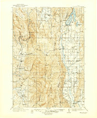
1911 Map of Meadows
USGS Topo · Published 1911About this map
Pacific and Idaho Northern rails cut through the western valley floor of this Idaho territory, serving small timber and ranching communities like Council and Fruitvale. This 1911 edition reflects a landscape defined by its high alpine lakes and early forest management, with Payette Lake at the northeast corner anchoring settlements like Lardo and McCall. The geography is fragmented by the borders of the Idaho National Forest, Weiser National Forest, and Payette National Forest, illustrating the early 20th-century emphasis on federal land conservation in the West.
Find a feature on this map
78 named features on this map. Tap any name to fly to it.
Don’t see what you’re looking for? This feature index may not catch every label — zoom into the map to look around manually.
Map Details
Editions of this 1911 Meadows Map
2 editions found
Other maps of this area

1894 · Squaw Creek
USGS Topo · 1:125,000

1897 · Weiser
USGS Topo · 1:125,000

1909 · Garden Valley
USGS Topo · 1:125,000

1920 · Seven Devils Mining District
USGS Topo · 1:48,000

1938 · Riggins
USGS Topo · 1:96,000

1945 · Riggins
USGS Topo · 1:125,000

1953 · Smiths Ferry
USGS Topo · 1:62,500

1953 · Boiling Springs
USGS Topo · 1:62,500

1954 · Gold Fork
USGS Topo · 1:62,500

1954 · Council
USGS Topo · 1:62,500