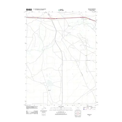
2012 Map of Meads
USGS Topo · Published 2012About this map
Walcott Junction and the surrounding high plains of Carbon County are defined by a network of ranching homesteads and transit corridors in this 2012 study. The map documents several established landholdings including the Peterson Ranch, Crone Ranch, and Hess Ranch, indicating a landscape still deeply tied to livestock and grazing. The drainage of Pass Cr meanders across the territory, punctuated by Stage Station Springs, a name that hints at the area's historical role in overland travel. Modern infrastructure and historical routes intersect here, with the Old Hwy and Rattlesnake Pass Rd providing access across the varied terrain. Further south, the map details the expansive Sand Basin and the small settlement of Meads, connected by the long stretch of Overland Dome Rd.
Find a feature on this map
12 named features on this map. Tap any name to fly to it.
Don’t see what you’re looking for? This feature index may not catch every label — zoom into the map to look around manually.
Map Details
Editions of this 2012 Meads Map
This is the sole edition of this map. No revisions or reprints were ever made.
Other maps of this area

1893 · Fort Steele
USGS Topo · 1:125,000

1914 · Hanna
USGS Topo · 1:62,500

1914 · Walcott
USGS Topo · 1:62,500

1954 · Rawlins
USGS Topo · 1:250,000

1955 · Overland
USGS Topo · 1:24,000

1955 · Overland Crossing
USGS Topo · 1:24,000

1955 · Coal Bank Basin
USGS Topo · 1:24,000

1955 · Oberg Ranch
USGS Topo · 1:24,000

1955 · Meads
USGS Topo · 1:24,000

1955 · Savage Ranch
USGS Topo · 1:24,000