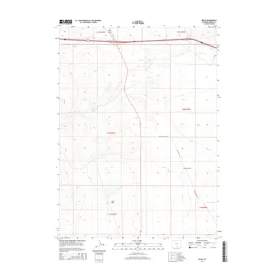
2015 Map of Meads
USGS Topo · Published 2015About this map
Stage Station Springs and the expansive Overland Flats define the high plains character of this Carbon County landscape. The area around Meads is primarily characterized by its drainage systems and historical transit corridors, with Pass Cr winding through the northern sections while the southern terrain transitions into the distinct depression of Sand Basin. The map captures a modern snapshot of rural Wyoming where primitive and improved routes like Rattlesnake Pass Rd and Overland Dome Rd follow the natural contours of the land. These roads provide access across a sparsely populated region defined by large township blocks and ranching-related water sources, reflecting the enduring isolation and topographical complexity of the high desert environment.
Find a feature on this map
14 named features on this map. Tap any name to fly to it.
Don’t see what you’re looking for? This feature index may not catch every label — zoom into the map to look around manually.
Map Details
Editions of this 2015 Meads Map
This is the sole edition of this map. No revisions or reprints were ever made.
Other maps of this area

1893 · Fort Steele
USGS Topo · 1:125,000

1914 · Hanna
USGS Topo · 1:62,500

1914 · Walcott
USGS Topo · 1:62,500

1954 · Rawlins
USGS Topo · 1:250,000

1955 · Overland
USGS Topo · 1:24,000

1955 · Overland Crossing
USGS Topo · 1:24,000

1955 · Coal Bank Basin
USGS Topo · 1:24,000

1955 · Oberg Ranch
USGS Topo · 1:24,000

1955 · Meads
USGS Topo · 1:24,000

1955 · Savage Ranch
USGS Topo · 1:24,000