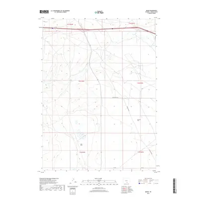
2017 Map of Meads
USGS Topo · Published 2017About this map
Stage Station Springs and the small settlement of Meads define the human geography of this high-elevation landscape in Carbon County. The terrain is characterized by broad geographic depressions and expansive levels, most notably the Sand Basin and the wide Overland Flats. This area was historically significant for western transit, as evidenced by the local naming conventions and proximity to transit corridors. The natural drainage of Pass Cr winds through the northern sections of the map, carving through the high plains. The infrastructure here is sparse, consisting largely of remote thoroughfares such as Rattlesnake Pass Rd and Overland Dome Rd, which connect these isolated points across the rugged Wyoming interior. This 2017 survey reflects the modern management of public and private lands in a region where water sources like the springs remained vital focal points for decades.
Find a feature on this map
15 named features on this map. Tap any name to fly to it.
Don’t see what you’re looking for? This feature index may not catch every label — zoom into the map to look around manually.
Map Details
Editions of this 2017 Meads Map
This is the sole edition of this map. No revisions or reprints were ever made.
Other maps of this area

1893 · Fort Steele
USGS Topo · 1:125,000

1914 · Hanna
USGS Topo · 1:62,500

1914 · Walcott
USGS Topo · 1:62,500

1954 · Rawlins
USGS Topo · 1:250,000

1955 · Overland
USGS Topo · 1:24,000

1955 · Overland Crossing
USGS Topo · 1:24,000

1955 · Coal Bank Basin
USGS Topo · 1:24,000

1955 · Oberg Ranch
USGS Topo · 1:24,000

1955 · Meads
USGS Topo · 1:24,000

1955 · Savage Ranch
USGS Topo · 1:24,000