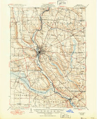
1925 Map of Meadville
USGS Topo · Published 1950About this map
French Creek dominates this Crawford County landscape, acting as the primary artery for transport and settlement during the 1920s. The valley is defined by a dense network of steam and electric transit, including the Erie RR and the Northwestern Electric line, which connected the urban hub of Meadville to outlying communities. This era reveals a rural society structured around localized infrastructure, evidenced by the high density of one-room schoolhouses like Delamater School and Wilkinson School that served farm families across townships like Hayfield and Woodcock.
Find a feature on this map
179 named features on this map. Tap any name to fly to it.
Don’t see what you’re looking for? This feature index may not catch every label — zoom into the map to look around manually.
Map Details
Editions of this 1925 Meadville Map
3 editions found

Other maps of this area

1900 · Girard
USGS Topo · 1:62,500

1906 · Linesville
USGS Topo · 1:62,500

1908 · Shenango
USGS Topo · 1:62,500

1908 · Linesville
USGS Topo · 1:62,500

1909 · Franklin
USGS Topo · 1:62,500

1911 · Franklin
USGS Topo · 1:62,500

1911 · Stoneboro
USGS Topo · 1:62,500

1913 · Stoneboro
USGS Topo · 1:62,500

1923 · Meadville
USGS Topo · 1:62,500

1923 · Cambridge Springs
USGS Topo · 1:62,500