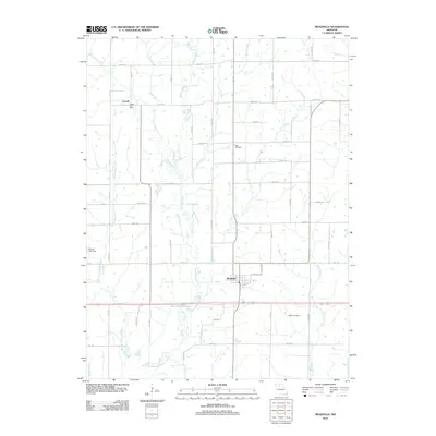
2012 Map of Meadville
USGS Topo · Published 2012About this map
Meadville serves as the primary hub of this Linn County landscape, where a grid of rural roads connects agricultural tracts divided by an intricate drainage system. The terrain is defined by the winding paths of Parson Creek and its many tributaries, including Coon Creek and Lousy Creek, which create a complex network of seasonal waterways and low-lying basins. To the northwest, the small settlement of Lowell remains anchored by the Lowell Post Office, a significant marker for local history researchers and genealogists tracing mail routes and early community centers.
Find a feature on this map
34 named features on this map. Tap any name to fly to it.
Don’t see what you’re looking for? This feature index may not catch every label — zoom into the map to look around manually.
Map Details
Editions of this 2012 Meadville Map
This is the sole edition of this map. No revisions or reprints were ever made.
Other maps of this area

1924 · Chula
USGS Topo · 1:62,500

1924 · Hale
USGS Topo · 1:62,500

1946 · Brookfield
USGS Topo · 1:62,500

1947 · Chula
USGS Topo · 1:62,500

1948 · Brookfield
USGS Topo · 1:62,500

1949 · Sumner
USGS Topo · 1:24,000

1950 · Sumner
USGS Topo · 1:24,000

1951 · Hale
USGS Topo · 1:62,500

1953 · Moberly
USGS Topo · 1:250,000

1954 · Moberly
USGS Topo · 1:250,000