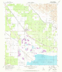
1955 Map of Mecca
USGS Topo · Published 1973About this map
The settlement of Mecca serves as the focal point for this desert landscape, situated at the edge of the Salton Sea just after mid-century. This survey highlights an environment defined by water management and ancestral lands, where the Torres Martinez Indian Reservation and Cabezon Indian Reservation cover significant portions of the valley floor. The vital role of irrigation in this arid basin is evident through the extensive Coachella Canal, numerous Duck Ponds, and a complex system of levees designed to direct the Whitewater River and manage seasonal storm flows.
Find a feature on this map
45 named features on this map. Tap any name to fly to it.
Don’t see what you’re looking for? This feature index may not catch every label — zoom into the map to look around manually.
Map Details
Editions of this 1955 Mecca Map
4 editions found

Other maps of this area

1904 · Indio
USGS Topo · 1:125,000

1931 · Vallecito
USGS Topo · 1:125,000

1940 · Cottonwood Spring
USGS Topo · 1:62,500

1940 · Durmid
USGS Topo · 1:62,500

1941 · Coachella
USGS Topo · 1:62,500

1942 · Agua Dulce
USGS Topo · 1:62,500

1943 · Vallecito
USGS Topo · 1:125,000

1943 · Coachella
USGS Topo · 1:62,500

1944 · Agua Dulce
USGS Topo · 1:62,500

1944 · Cottonwood Spring
USGS Topo · 1:62,500