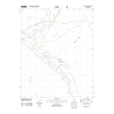
2011 Map of Medanales
USGS Topo · Published 2011About this map
The Rio Chama valley north of Abiquiu defines the landscape of this 2011 survey, where the river's path has long supported human habitation. The settlement of Medanales serves as a central point, anchored by the Medanales Post Office, while the smaller community of Tierra Azul sits to the northwest near the confluence with El Rito. This area is particularly significant for its cultural heritage, containing the Tsama Archaeological District and the Leafwater Archaeological District on the terrace above the riverbanks. The surrounding terrain is a network of deep drainage features, including Cañada Ancha and Cañada Honda, which cut through the high ground of Llano Lobato. To the east, the prominent Rincon Del Cuervo overlooks the valley, while agricultural and ranching history is marked by the Quarter Circle Ranch and a complex web of local routes like County Rd 142 and Apache Rd.
Find a feature on this map
28 named features on this map. Tap any name to fly to it.
Don’t see what you’re looking for? This feature index may not catch every label — zoom into the map to look around manually.
Map Details
Editions of this 2011 Medanales Map
This is the sole edition of this map. No revisions or reprints were ever made.
Other maps of this area

1918 · Abiquiu
USGS Topo · 1:125,000

1953 · Chili
USGS Topo · 1:24,000

1953 · Abiquiu
USGS Topo · 1:24,000

1953 · Medanales
USGS Topo · 1:24,000

1953 · Vallecitos
USGS Topo · 1:24,000

1953 · San Juan Pueblo
USGS Topo · 1:24,000

1953 · Lyden
USGS Topo · 1:24,000

1953 · El Rito
USGS Topo · 1:24,000

1953 · Ojo Caliente
USGS Topo · 1:24,000

1953 · Canjilon SE
USGS Topo · 1:24,000