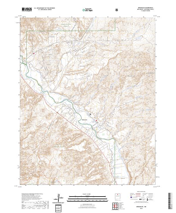
2023 Map of Medanales
USGS Topo · Published 2023About this map
Rio Chama flows through the heart of this landscape, carving a valley that has long sustained the settlement at Medanales. This 2023 survey illustrates the convergence of federal lands and local history, where the southern boundary of the Carson National Forest meets the northern reaches of the Santa Fe National Forest. The map documents a dense network of residential development north of the river, particularly near El Rito Ests and Llano Lobato, while the southern terrain remains defined by rugged arroyos and canyons.
Find a feature on this map
57 named features on this map. Tap any name to fly to it.
Don’t see what you’re looking for? This feature index may not catch every label — zoom into the map to look around manually.
Map Details
Editions of this 2023 Medanales Map
This is the sole edition of this map. No revisions or reprints were ever made.
Other maps of this area

1918 · Abiquiu
USGS Topo · 1:125,000

1953 · Chili
USGS Topo · 1:24,000

1953 · Abiquiu
USGS Topo · 1:24,000

1953 · Medanales
USGS Topo · 1:24,000

1953 · Vallecitos
USGS Topo · 1:24,000

1953 · San Juan Pueblo
USGS Topo · 1:24,000

1953 · Lyden
USGS Topo · 1:24,000

1953 · El Rito
USGS Topo · 1:24,000

1953 · Ojo Caliente
USGS Topo · 1:24,000

1953 · Canjilon SE
USGS Topo · 1:24,000