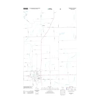
2013 Map of Medford
USGS Topo · Published 2013About this map
Medford serves as the primary hub of this landscape, situated at the confluence of the Black River and the Medford Flowage. The town's grid of streets, including W Broadway Ave and E Allman St, gives way to a network of rural routes that fan out across Taylor County. North of the city, the settlement of Whittlesey marks a key point along the Wi-13 corridor. The geography is defined by a dense system of waterways, most notably the several branches of the Little Black River, including the W Br Little Black River and E Br Little Black River. In the northwestern corner, a cluster of small glacial lakes such as Horseshoe Lake, Clarke Lake, and Bullhead Lake provide a distinct contrast to the agricultural and residential patterns that dominate the rest of the quadrangle.
Find a feature on this map
86 named features on this map. Tap any name to fly to it.
Don’t see what you’re looking for? This feature index may not catch every label — zoom into the map to look around manually.
Map Details
Editions of this 2013 Medford Map
This is the sole edition of this map. No revisions or reprints were ever made.
Other maps of this area

1902 · Marathon
USGS Topo · 1:125,000

1944 · Ogema
USGS Topo · 1:48,000

1945 · Rib Lake
USGS Topo · 1:48,000

1947 · Rib Lake
USGS Topo · 1:48,000

1947 · Ogema
USGS Topo · 1:48,000

1949 · Ogema
USGS Topo · 1:48,000

1949 · Rib Lake
USGS Topo · 1:48,000

1951 · Athens
USGS Topo · 1:48,000

1951 · Medford
USGS Topo · 1:48,000

1953 · Rice Lake
USGS Topo · 1:250,000