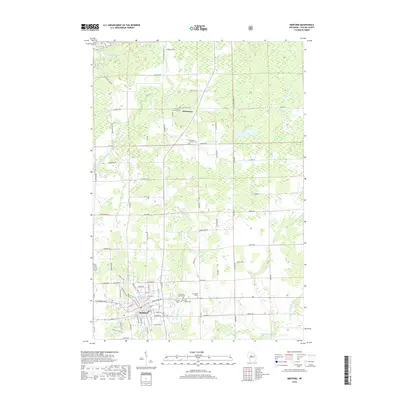
2018 Map of Medford
USGS Topo · Published 2018About this map
The city of Medford serves as the focal point of this Taylor County landscape, situated along the winding course of the Black River and its varied tributaries. The 2018 survey reveals a community deeply connected to its local heritage, evidenced by the dense cluster of cemeteries on the outskirts of the city, including Evergreen Cem I, Evergreen Cem II, and the Holy Rosary Cem. To the north, the smaller settlement of Whittlesey stands near the Whittlesey Catholic Cem and Whittlesey Lutheran Cem, illustrating the importance of local parishes in the region's development.
Find a feature on this map
89 named features on this map. Tap any name to fly to it.
Don’t see what you’re looking for? This feature index may not catch every label — zoom into the map to look around manually.
Map Details
Editions of this 2018 Medford Map
This is the sole edition of this map. No revisions or reprints were ever made.
Other maps of this area

1902 · Marathon
USGS Topo · 1:125,000

1944 · Ogema
USGS Topo · 1:48,000

1945 · Rib Lake
USGS Topo · 1:48,000

1947 · Rib Lake
USGS Topo · 1:48,000

1947 · Ogema
USGS Topo · 1:48,000

1949 · Ogema
USGS Topo · 1:48,000

1949 · Rib Lake
USGS Topo · 1:48,000

1951 · Athens
USGS Topo · 1:48,000

1951 · Medford
USGS Topo · 1:48,000

1953 · Rice Lake
USGS Topo · 1:250,000