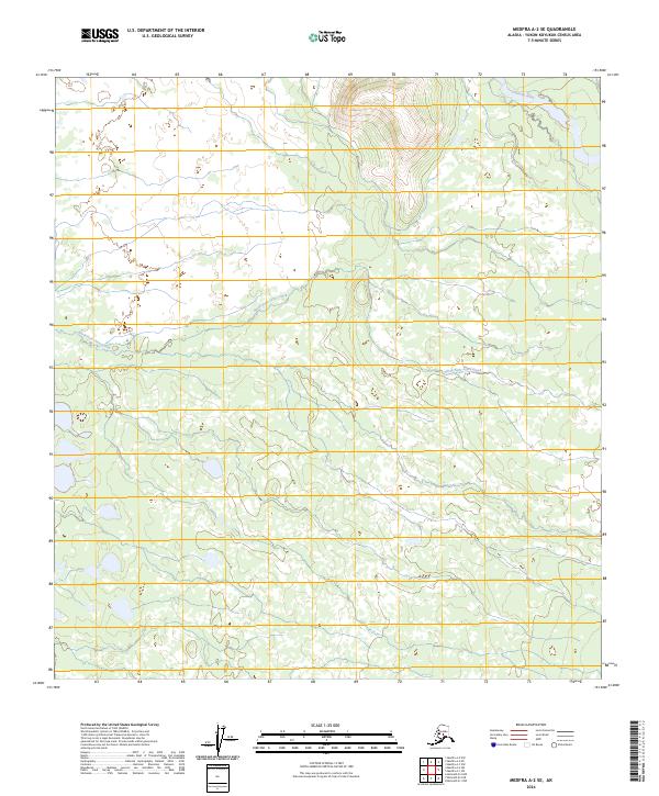
2024 Map of Medfra A-2 SE
USGS Topo · Published 2024About this map
Tonzona River flows through the northern reaches of this remote Alaska interior landscape, situated within the Yukon-Koyukuk Census Area. This region is characterized by significant topographic variation, as the high ground in the north descends toward the expansive lowlands that dominate the southern half of the quadrangle. The hydrology is defined by the North Fork Jones Creek, which meanders through a complex network of wetlands and small water bodies. The terrain reflects the classic drainage patterns of the Alaskan bush, where glacial runoff and seasonal melt sustain a dense system of creeks and rivers. Land management in this area is organized by the Public Land Survey System, with the map covering portions of t27s r27e, t27s r28e, and extending south into t29s r28e. The absence of roads or established settlements emphasizes the wilderness character of this territory, where watercourses serve as the primary natural corridors.
Find a feature on this map
8 named features on this map. Tap any name to fly to it.
Don’t see what you’re looking for? This feature index may not catch every label — zoom into the map to look around manually.
Map Details
Editions of this 2024 Medfra A-2 SE Map
This is the sole edition of this map. No revisions or reprints were ever made.
Other maps of this area

1949 · McGrath
USGS Topo · 1:250,000

1950 · Medfra
USGS Topo · 1:250,000

1950 · McGrath
USGS Topo · 1:250,000

1958 · McGrath D-2
USGS Topo · 1:63,360

1958 · Medfra A-2
USGS Topo · 1:63,360

1958 · Medfra A-1
USGS Topo · 1:63,360

1958 · McGrath D-1
USGS Topo · 1:63,360

1958 · McGrath
USGS Topo · 1:250,000

1959 · Medfra
USGS Topo · 1:250,000
2019 · McGrath D-1 NW
USGS Topo · 1:25,000