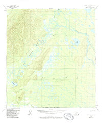
1958 Map of Medfra A-2
USGS Topo · Published 1988About this map
The East Fork Kuskokwim River and Tonzona River dominate this interior Alaskan landscape, which was mapped from aerial photography in the mid-1950s. The terrain is defined by a complex network of meandering waterways and glacial lakes, including Lake Hoyle and Demagiemina Lake. High ground is found in the East Fork Hills to the northwest and the Baby Basket Hills in the southwest, where Moose Hill rises above the marshy lowlands. Human presence is sparse, marked primarily by a Winter Trail cutting through the center of the quadrangle and a remote Landing Strip near the Slow Fork. The convergence of North Fork Jones Creek and South Fk Jones Creek further emphasizes the watershed's importance for local travel and seasonal subsistence in this roadless wilderness.
Find a feature on this map
14 named features on this map. Tap any name to fly to it.
Don’t see what you’re looking for? This feature index may not catch every label — zoom into the map to look around manually.
Map Details
Editions of this 1958 Medfra A-2 Map
3 editions found
Other maps of this area

1949 · McGrath
USGS Topo · 1:250,000

1950 · Medfra
USGS Topo · 1:250,000

1950 · McGrath
USGS Topo · 1:250,000

1954 · McGrath D-3
USGS Topo · 1:63,360

1954 · Medfra A-3
USGS Topo · 1:63,360

1955 · Medfra B-3
USGS Topo · 1:63,360

1958 · McGrath D-2
USGS Topo · 1:63,360

1958 · Medfra A-2
USGS Topo · 1:63,360

1958 · Medfra B-2
USGS Topo · 1:63,360

1958 · Medfra A-1
USGS Topo · 1:63,360