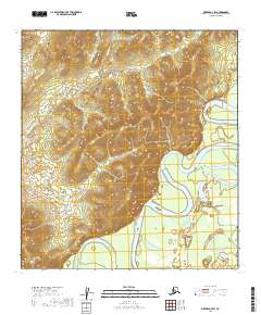
2019 Map of Medfra A-4 SW
USGS Topo · Published 2019About this map
The Kuskokwim River meanders through this portion of the Yukon-Koyukuk Census Area, creating a complex network of oxbows and riverbends. The landscape is defined by the sharp contrast between the active floodplain of the river and the surrounding high ground where several smaller waterways originate. To the north, Crooked Cr follows a winding path across the terrain, joined by tributaries such as Eagle Cr and Skookum Cr. These watercourses represent the primary navigational and geographical markers in this interior Alaskan wilderness, highlighting the natural drainage patterns that have shaped the region long before modern surveying. The map provides a detailed record of the township and range system, including t27s r21e and t28s r21e, which organize this undeveloped territory for administrative and land-use purposes.
Find a feature on this map
12 named features on this map. Tap any name to fly to it.
Don’t see what you’re looking for? This feature index may not catch every label — zoom into the map to look around manually.
Map Details
Editions of this 2019 Medfra A-4 SW Map
This is the sole edition of this map. No revisions or reprints were ever made.
Other maps of this area

1949 · McGrath
USGS Topo · 1:250,000

1950 · Medfra
USGS Topo · 1:250,000

1950 · McGrath
USGS Topo · 1:250,000

1953 · McGrath D-5
USGS Topo · 1:63,360

1953 · McGrath D-4
USGS Topo · 1:63,360

1954 · Medfra A-5
USGS Topo · 1:63,360

1958 · McGrath
USGS Topo · 1:250,000
1959 · Medfra A-4
USGS Topo · 1:63,360

1959 · Medfra
USGS Topo · 1:250,000
2019 · McGrath D-5 NE
USGS Topo · 1:25,000