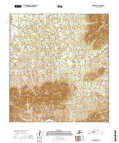
2019 Map of Medfra A-5 SW
USGS Topo · Published 2019About this map
The Kuskokwim River defines the southern edge of this remote Interior Alaska landscape, where low-lying wetlands give way to rising upland terrain. In the southwestern corner, the prominent rise of Appel Mtn stands as a significant landmark above the surrounding drainage basins. The area is characterized by a complex network of seasonal watercourses and ponds, most notably the meandering Broken Snowshoe Cr and Grayling Cr. This 2019 survey illustrates the untouched character of the Yukon-Koyukuk region, lacking any established roads or permanent settlements within the quadrangle. The topography suggests a wilderness transition, where the river's influence on the land is countered by the isolated peaks that guide local drainage patterns.
Find a feature on this map
10 named features on this map. Tap any name to fly to it.
Don’t see what you’re looking for? This feature index may not catch every label — zoom into the map to look around manually.
Map Details
Editions of this 2019 Medfra A-5 SW Map
This is the sole edition of this map. No revisions or reprints were ever made.
Other maps of this area

1949 · McGrath
USGS Topo · 1:250,000

1950 · Medfra
USGS Topo · 1:250,000

1950 · McGrath
USGS Topo · 1:250,000

1953 · McGrath D-5
USGS Topo · 1:63,360

1954 · Medfra A-6
USGS Topo · 1:63,360

1954 · McGrath D-6
USGS Topo · 1:63,360

1954 · Medfra A-5
USGS Topo · 1:63,360

1958 · McGrath
USGS Topo · 1:250,000

1959 · Medfra
USGS Topo · 1:250,000
2019 · McGrath D-5 NW
USGS Topo · 1:25,000