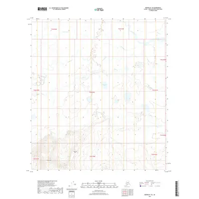
2019 Map of Medfra B-1 SE
USGS Topo · Published 2019About this map
Slow Fork Hills and Grayling Hill dominate the southern reaches of this interior Alaskan landscape, providing significant relief above the surrounding wetlands. This 2019 survey, produced by the U.S. Geological Survey, documents a complex drainage network where the Slow Fork and Swift Fork rivers navigate the lowlands. The terrain is defined by its water, including the central No Name Lake and numerous tributary systems like Tonclonukna Cr, Telidaside Cr, and Middle Cr. This region of the Yukon-Koyukuk Census Area remains largely undeveloped, with no roads or settlements indicated, showing instead the natural meandering patterns of glacial-fed streams and isolated hills characteristic of the Alaskan wilderness before human infrastructure takes hold.
Find a feature on this map
18 named features on this map. Tap any name to fly to it.
Don’t see what you’re looking for? This feature index may not catch every label — zoom into the map to look around manually.
Map Details
Editions of this 2019 Medfra B-1 SE Map
This is the sole edition of this map. No revisions or reprints were ever made.
Other maps of this area

1950 · Medfra
USGS Topo · 1:250,000

1952 · Mount McKinley
USGS Topo · 1:250,000

1958 · Medfra A-1
USGS Topo · 1:63,360

1958 · Mount McKinley B-6
USGS Topo · 1:63,360

1958 · Mount McKinley A-6
USGS Topo · 1:63,360

1958 · Mount McKinley
USGS Topo · 1:250,000

1958 · Medfra B-1
USGS Topo · 1:63,360

1959 · Medfra
USGS Topo · 1:250,000

1969 · Mount McKinley
USGS Topo · 1:250,000
2017 · Denali B-6 SW
USGS Topo · 1:25,000