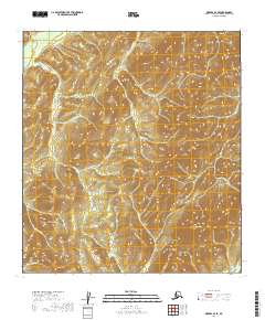
2019 Map of Medfra B-4 SE
USGS Topo · Published 2019About this map
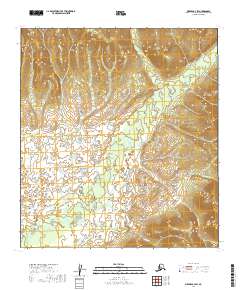
Limestone Mtn and Strand Peak anchor this remote interior Alaska landscape, which is defined by a dense network of watercourses and steep topography. The drainage patterns are dominated by Nixon Fork in the northwest, which is fed by Jones Cr as it winds through the northern sections of the survey. The terrain is marked by significant elevations including Jumbo Peak and Greer Gulch in the southwest, suggesting a landscape shaped by narrow valleys and seasonal runoff. The complex hydrography, featuring Boulder Cr, Medicine Cr, and the curiously named Submarine Cr, indicates a region where traditional overland travel would be dictated by these small-scale watersheds. As a modern survey, the map provides a high-resolution view of the natural relief within the t25s r22e and t25s r23e land survey grids before human infrastructure had made significant inroads into the Yukon-Koyukuk region.
Find a feature on this map
18 named features on this map. Tap any name to fly to it.
Don’t see what you’re looking for? This feature index may not catch every label — zoom into the map to look around manually.
Map Details
Editions of this 2019 Medfra B-4 SE Map
This is the sole edition of this map. No revisions or reprints were ever made.
Other maps of this area

1950 · Medfra
USGS Topo · 1:250,000

1953 · Medfra B-4
USGS Topo · 1:63,360

1954 · Medfra A-3
USGS Topo · 1:63,360

1955 · Medfra B-3
USGS Topo · 1:63,360
1959 · Medfra A-4
USGS Topo · 1:63,360

1959 · Medfra
USGS Topo · 1:250,000
2019 · Medfra B-4 NW
USGS Topo · 1:25,000
2019 · Medfra A-4 NE
USGS Topo · 1:25,000
2019 · Medfra B-4 SW
USGS Topo · 1:25,000
2019 · Medfra A-3 NW
USGS Topo · 1:25,000