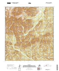
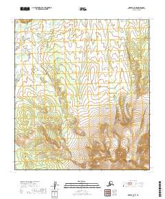
2019 Map of Medfra B-4 NW
USGS Topo · Published 2019About this map
The Sunshine Mountains and the Kuskokwim Mountains converge in this high-altitude interior region, forming a complex watershed of mountain streams. This landscape is defined by the steep, unpopulated slopes that feed drainage systems like Hosmer Cr and Meadow Cr. Unlike many Alaskan quadrants that feature settlements or mining camps, this area remains focused on the raw topography of the central interior.
Find a feature on this map
10 named features on this map. Tap any name to fly to it.
Don’t see what you’re looking for? This feature index may not catch every label — zoom into the map to look around manually.
Map Details
Editions of this 2019 Medfra B-4 NW Map
This is the sole edition of this map. No revisions or reprints were ever made.
Other maps of this area

1950 · Medfra
USGS Topo · 1:250,000

1953 · Medfra B-4
USGS Topo · 1:63,360

1953 · Medfra B-5
USGS Topo · 1:63,360

1953 · Medfra C-4
USGS Topo · 1:63,360

1954 · Medfra C-5
USGS Topo · 1:63,360

1959 · Medfra
USGS Topo · 1:250,000
2019 · Medfra C-4 SE
USGS Topo · 1:25,000
2019 · Medfra B-4 SW
USGS Topo · 1:25,000
2019 · Medfra B-4 SE
USGS Topo · 1:25,000
2019 · Medfra C-5 SE
USGS Topo · 1:25,000