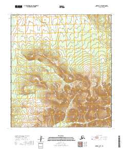
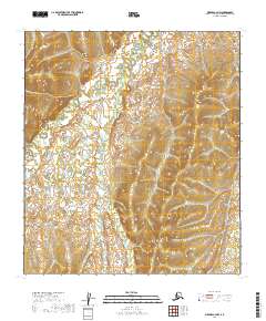
2019 Map of Medfra C-4 SE
USGS Topo · Published 2019About this map
The Kuskokwim Mountains dominate this high-elevation interior Alaskan landscape, providing a clear view of the drainage patterns and geological structures in the Yukon-Koyukuk region. In the southeastern portion of the map, the Mystery Mountains rise sharply, culminating at Mystery Mtn. This area is defined by its pristine hydraulic network, where small seasonal and permanent streams begin their descent from the ridges. Notable among these are Meadow Cr in the northwest, Canyon Cr carving through the central slopes, and Cottonwood Cr at the southern edge. The map captures a wilderness area devoid of modern infrastructure or permanent settlements, reflecting the isolation of the Alaskan interior as it remained into the early twenty-first century.
Find a feature on this map
15 named features on this map. Tap any name to fly to it.
Don’t see what you’re looking for? This feature index may not catch every label — zoom into the map to look around manually.
Map Details
Editions of this 2019 Medfra C-4 SE Map
This is the sole edition of this map. No revisions or reprints were ever made.
Other maps of this area

1950 · Medfra
USGS Topo · 1:250,000

1953 · Medfra B-4
USGS Topo · 1:63,360

1953 · Medfra C-4
USGS Topo · 1:63,360

1954 · Medfra C-3
USGS Topo · 1:63,360

1955 · Medfra B-3
USGS Topo · 1:63,360

1959 · Medfra
USGS Topo · 1:250,000
2019 · Medfra B-4 NW
USGS Topo · 1:25,000
2019 · Medfra C-3 NW
USGS Topo · 1:25,000
2019 · Medfra C-3 SW
USGS Topo · 1:25,000
2019 · Medfra C-4 NW
USGS Topo · 1:25,000