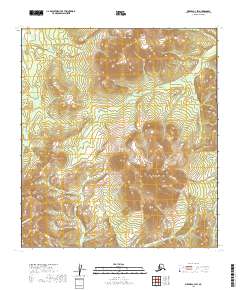
2019 Map of Medfra C-3 SW
USGS Topo · Published 2019About this map
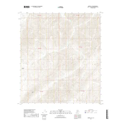
Von Frank Mtn stands as a central topographic anchor within this interior Alaskan landscape, which is part of the broader Kuskokwim Mountains system. The terrain is defined by a series of significant drainage basins where high ridgelines give way to the headwaters of several remote waterways. Flowing through the deep valleys of this quadrangle, Von Frank Cr and Shepherd Cr move through the eastern and central sections, while the Mystery Mountains rise to the west. The absence of roads or established settlements emphasizes the wilderness character of the region, where surveyors have documented the natural hydrography including Cottonwood Cr and Flax Cr. For those studying the geography of the Yukon-Koyukuk Census Area, this map details the complex drainage patterns and elevation profiles that define this subarctic environment.
Find a feature on this map
14 named features on this map. Tap any name to fly to it.
Don’t see what you’re looking for? This feature index may not catch every label — zoom into the map to look around manually.
Map Details
Editions of this 2019 Medfra C-3 SW Map
This is the sole edition of this map. No revisions or reprints were ever made.
Other maps of this area

1950 · Medfra
USGS Topo · 1:250,000

1953 · Medfra B-4
USGS Topo · 1:63,360

1953 · Medfra C-4
USGS Topo · 1:63,360

1954 · Medfra C-3
USGS Topo · 1:63,360

1955 · Medfra B-3
USGS Topo · 1:63,360

1959 · Medfra
USGS Topo · 1:250,000
2019 · Medfra B-3 NE
USGS Topo · 1:25,000
2019 · Medfra C-4 SE
USGS Topo · 1:25,000
2019 · Medfra C-3 NW
USGS Topo · 1:25,000
2019 · Medfra C-3 SE
USGS Topo · 1:25,000