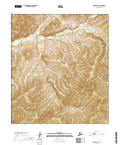
2019 Map of Medfra D-6 SE
USGS Topo · Published 2019About this map
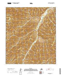
Our Creek flows through the northern reaches of this interior landscape in the Yukon-Koyukuk Census Area. This region, defined by its extensive drainage patterns and significant elevation changes, is largely untouched by infrastructure or permanent settlements. The map highlights the intersecting boundaries of the Public Land Survey System, specifically detailing the corners of t19s r16e, t19s r17e, t20s r16e, and t20s r17e. These surveyed townships and ranges serve as the primary navigational framework for a territory otherwise marked by ridges and seasonal waterways. The isolation of the terrain suggests a wilderness area primarily utilized for remote activities or resource management rather than residential development.
Find a feature on this map
5 named features on this map. Tap any name to fly to it.
Don’t see what you’re looking for? This feature index may not catch every label — zoom into the map to look around manually.
Map Details
Editions of this 2019 Medfra D-6 SE Map
This is the sole edition of this map. No revisions or reprints were ever made.
Other maps of this area

1950 · Medfra
USGS Topo · 1:250,000

1954 · Medfra C-6
USGS Topo · 1:63,360

1954 · Medfra C-5
USGS Topo · 1:63,360

1954 · Medfra D-5
USGS Topo · 1:63,360

1954 · Medfra D-6
USGS Topo · 1:63,360

1959 · Medfra
USGS Topo · 1:250,000
2019 · Medfra D-6 NE
USGS Topo · 1:25,000
2019 · Medfra D-5 SW
USGS Topo · 1:25,000
2019 · Medfra C-5 NW
USGS Topo · 1:25,000
2019 · Medfra D-5 NW
USGS Topo · 1:25,000