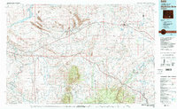
1980 Map of Medicine Bow
USGS Topo · Published 1980About this map
Hanna and the adjacent town of Elmo stand as central points of industry in this Wyoming landscape, where the Strip Mine and Vanguard Mine No 1 reflect the region's coal legacy. The map captures a critical transportation corridor where the historic Overland Trail is shadowed by modern improvements, following the path of the Union Pacific Railroad through the plains. To the south, the massive bulk of Elk Mountain dominates the horizon above McFadden, while the northern reaches are defined by the Seminoe Reservoir and the North Platte River. This 1:100,000 scale survey illustrates the relationship between these rail towns and the natural geography of the Como Bluffs and Saint Marys Ridge, providing a clear picture of the High Plains environment before the turn of the 21st century.
Find a feature on this map
48 named features on this map. Tap any name to fly to it.
Don’t see what you’re looking for? This feature index may not catch every label — zoom into the map to look around manually.
Map Details
Editions of this 1980 Medicine Bow Map
This is the sole edition of this map. No revisions or reprints were ever made.
Other maps of this area

1893 · Fort Steele
USGS Topo · 1:125,000

1895 · Laramie
USGS Topo · 1:125,000

1902 · Laramie
USGS Topo · 1:125,000

1905 · Laramie
USGS Topo · 1:125,000

1906 · Medicine Bow
USGS Topo · 1:125,000

1906 · Laramie
USGS Topo · 1:125,000

1908 · Laramie
USGS Topo · 1:125,000

1908 · Medicine Bow
USGS Topo · 1:125,000

1914 · Hanna
USGS Topo · 1:62,500

1914 · Walcott
USGS Topo · 1:62,500