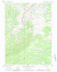
1961 Map of Medicine Bow Peak
USGS Topo · Published 1984About this map
Medicine Bow Peak and the high-altitude landscape of the Snowy Range dominate this topography, captured in a period of late-twentieth-century forest management and recreational development. The map details the complex drainage systems of the Medicine Bow Mountains, where numerous alpine water bodies like Lake Marie, Lookout Lake, and Mirror Lake cluster around the base of the peaks. Settlement is sparse, represented primarily by administrative and recreational nodes such as Headquarters Park and the Silver Lake Campground. The presence of several Jeep Trails and Foot Trails suggests a landscape transitioning toward more intensive recreational use within the Medicine Bow National Forest. The boundary between Carbon and Albany Counties bisects the rugged terrain, marking a divide between the higher summits and the lower meadows of Willow Park and Fourlog Park.
Find a feature on this map
54 named features on this map. Tap any name to fly to it.
Don’t see what you’re looking for? This feature index may not catch every label — zoom into the map to look around manually.
Map Details
Editions of this 1961 Medicine Bow Peak Map
4 editions found
Other maps of this area

1906 · Medicine Bow
USGS Topo · 1:125,000

1908 · Medicine Bow
USGS Topo · 1:125,000

1954 · Rawlins
USGS Topo · 1:250,000

1958 · Rawlins
USGS Topo · 1:250,000

1961 · Overlook Hill
USGS Topo · 1:24,000

1961 · Sand Lake
USGS Topo · 1:24,000

1961 · Medicine Bow Peak
USGS Topo · 1:24,000
1961 · Phantom Lake
USGS Topo · 1:24,000
1961 · Centennial
USGS Topo · 1:24,000
1961 · Morgan
USGS Topo · 1:24,000