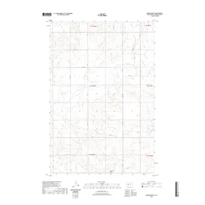
2020 Map of Medicine Butte
USGS Topo · Published 2020About this map
Medicine Butte rises as a prominent landmark in this Mercer County landscape, anchoring the southern portion of a territory defined by the winding course of the Knife River. The river cuts through the northern half of the quadrangle, creating a distinct drainage pattern supported by tributaries like Mud Cr. This topography reflects the typical prairie upland character of North Dakota, where the elevation changes around the butte provide a stark contrast to the surrounding river valley.
Find a feature on this map
21 named features on this map. Tap any name to fly to it.
Don’t see what you’re looking for? This feature index may not catch every label — zoom into the map to look around manually.
Map Details
Editions of this 2020 Medicine Butte Map
This is the sole edition of this map. No revisions or reprints were ever made.
Other maps of this area

1953 · Watford City
USGS Topo · 1:250,000

1954 · McClusky
USGS Topo · 1:250,000

1957 · Watford City
USGS Topo · 1:250,000

1958 · McClusky
USGS Topo · 1:250,000

1967 · Watford City
USGS Topo · 1:250,000

1968 · Beulah
USGS Topo · 1:24,000

1968 · Medicine Butte NE
USGS Topo · 1:24,000

1968 · Medicine Butte
USGS Topo · 1:24,000

1969 · Zap
USGS Topo · 1:24,000
1972 · Medicine Butte SW
USGS Topo · 1:24,000