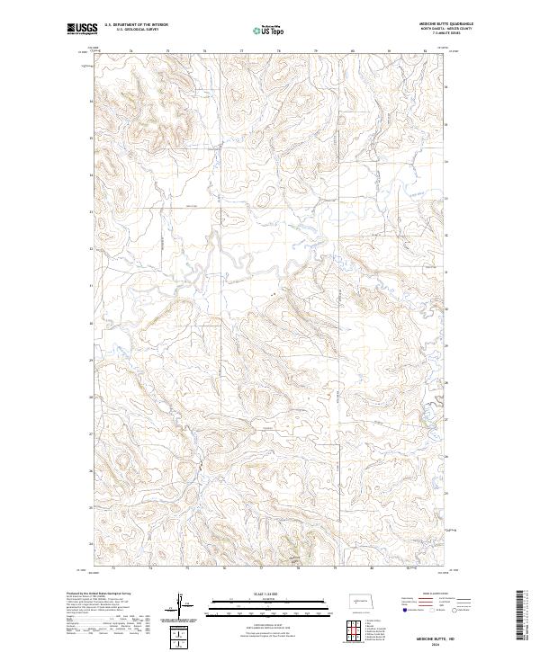
2024 Map of Medicine Butte
USGS Topo · Published 2024About this map
Medicine Butte dominates the southern landscape of this Mercer County quadrant, rising above a network of drainages and section-line roads. The Knife River meanders prominently through the central and northern reaches, defining the local topography alongside its tributary, Mud Creek. This 2024 survey documents the organized rural grid system of the Great Plains, where county routes like Co Rd 11 and Co Rd 13 provide access to the vast agricultural sections between the river valleys. The map illustrates the persistent structure of North Dakota's township and range system, showing the precise boundaries of t143n r89w and neighboring townships. For the local historian or researcher, the map preserves the exact alignment of modern rural infrastructure against the enduring natural landmarks of the Missouri River plateau.
Find a feature on this map
20 named features on this map. Tap any name to fly to it.
Don’t see what you’re looking for? This feature index may not catch every label — zoom into the map to look around manually.
Map Details
Editions of this 2024 Medicine Butte Map
This is the sole edition of this map. No revisions or reprints were ever made.
Other maps of this area

1953 · Watford City
USGS Topo · 1:250,000

1954 · McClusky
USGS Topo · 1:250,000

1957 · Watford City
USGS Topo · 1:250,000

1958 · McClusky
USGS Topo · 1:250,000

1967 · Watford City
USGS Topo · 1:250,000

1968 · Beulah
USGS Topo · 1:24,000

1968 · Medicine Butte NE
USGS Topo · 1:24,000

1968 · Medicine Butte
USGS Topo · 1:24,000

1969 · Zap
USGS Topo · 1:24,000
1972 · Medicine Butte SW
USGS Topo · 1:24,000