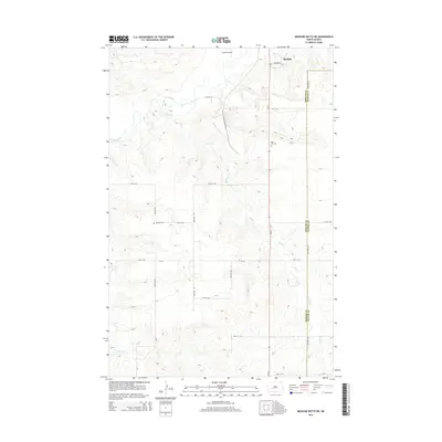
2014 Map of Medicine Butte NE
USGS Topo · Published 2014About this map
Beulah serves as the primary hub in this portion of Mercer County, situated along the winding course of the Knife River. The landscape is characterized by the convergence of several drainages, most notably Brush Creek and Coyote Creek, which shape the local topography. This 2014 survey illustrates the ongoing relationship between the established townsite and the surrounding rural landscape, including the Beulah Airport north of the residential center. Genealogists and local historians can locate several important community markers, including Rose Hill Cemetery east of the main road and Emmaus Cemetery further west. The boundary between Mercer County and Oliver County runs north-south along the eastern edge of the map, defining the administrative limits of these prairie communities as they appeared in the early 21st century.
Find a feature on this map
17 named features on this map. Tap any name to fly to it.
Don’t see what you’re looking for? This feature index may not catch every label — zoom into the map to look around manually.
Map Details
Editions of this 2014 Medicine Butte NE Map
This is the sole edition of this map. No revisions or reprints were ever made.
Other maps of this area

1954 · McClusky
USGS Topo · 1:250,000

1958 · McClusky
USGS Topo · 1:250,000

1968 · Beulah
USGS Topo · 1:24,000

1968 · Medicine Butte NE
USGS Topo · 1:24,000

1968 · Red Butte NW
USGS Topo · 1:24,000

1968 · Hazen West
USGS Topo · 1:24,000

1968 · Medicine Butte
USGS Topo · 1:24,000

1969 · Zap
USGS Topo · 1:24,000
1972 · Medicine Butte SW
USGS Topo · 1:24,000
1972 · Red Butte SW
USGS Topo · 1:24,000