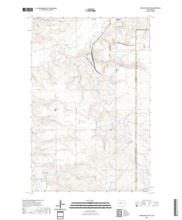
2024 Map of Medicine Butte NE
USGS Topo · Published 2024About this map
Knife River meanders across the northern portion of this landscape, carving a valley through the high plains of Mercer County. The southern edge of Beulah is visible at the northern margin, where local roads like Murray Dr and Cottontail Dr serve the outskirts of the community. The area is defined by a grid of rural section roads, including Co Rd 12 and Co Rd 25, which connect isolated homesteads and local landmarks. Genealogists will find interest in the Rose Hill Cem located near the northern township boundary and Emmaus Cem situated further west. The terrain is deeply incised by drainages such as Brush Creek, illustrating the natural erosion patterns of the Missouri Plateau before these seasonal waters reach the larger river systems.
Find a feature on this map
27 named features on this map. Tap any name to fly to it.
Don’t see what you’re looking for? This feature index may not catch every label — zoom into the map to look around manually.
Map Details
Editions of this 2024 Medicine Butte NE Map
This is the sole edition of this map. No revisions or reprints were ever made.
Other maps of this area

1954 · McClusky
USGS Topo · 1:250,000

1958 · McClusky
USGS Topo · 1:250,000

1968 · Beulah
USGS Topo · 1:24,000

1968 · Medicine Butte NE
USGS Topo · 1:24,000

1968 · Red Butte NW
USGS Topo · 1:24,000

1968 · Hazen West
USGS Topo · 1:24,000

1968 · Medicine Butte
USGS Topo · 1:24,000

1969 · Zap
USGS Topo · 1:24,000
1972 · Medicine Butte SW
USGS Topo · 1:24,000
1972 · Red Butte SW
USGS Topo · 1:24,000