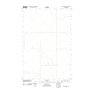
2011 Map of Medicine Butte SW
USGS Topo · Published 2011About this map
Gold Creek and Mud Creek converge in the northern reaches of this Mercer County landscape, defining a drainage pattern that has dictated the placement of section-line roads and homesteads for generations. The terrain is structured by a grid of rural routes, including County Rd 13 and 23rd St SW, which link the high-prairie acreage to regional centers. Further south, the meandering path of Elm Creek cuts across the survey, creating a natural break in the geometric regularity of the farmland. This 2011 record documents a sparsely populated agricultural environment where the land use is defined by massive open tracts and the essential watercourses that sustain them. It offers a clear view of the rural infrastructure at the start of the decade, showing the exact alignment of roads like 71st Ave SW and 27th St SW as they navigate the local topography.
Find a feature on this map
12 named features on this map. Tap any name to fly to it.
Don’t see what you’re looking for? This feature index may not catch every label — zoom into the map to look around manually.
Map Details
Editions of this 2011 Medicine Butte SW Map
This is the sole edition of this map. No revisions or reprints were ever made.
Other maps of this area

1953 · Dickinson
USGS Topo · 1:250,000

1953 · Watford City
USGS Topo · 1:250,000

1954 · Bismarck
USGS Topo · 1:250,000

1954 · McClusky
USGS Topo · 1:250,000

1957 · Dickinson
USGS Topo · 1:250,000

1957 · Watford City
USGS Topo · 1:250,000

1958 · Bismarck
USGS Topo · 1:250,000

1958 · McClusky
USGS Topo · 1:250,000

1967 · Watford City
USGS Topo · 1:250,000

1968 · Medicine Butte NE
USGS Topo · 1:24,000