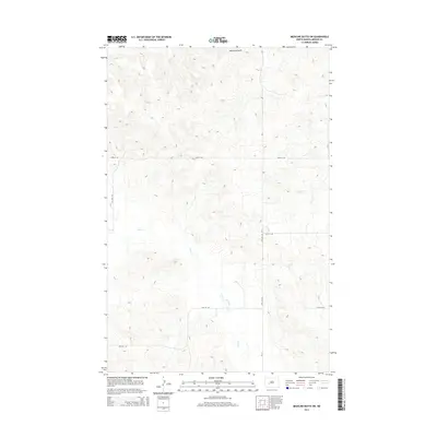
2014 Map of Medicine Butte SW
USGS Topo · Published 2014About this map
Medicine Butte rises as the central landmark in this Mercer County landscape, a prominent terrain feature overlooking a network of seasonal watercourses. The drainage patterns are defined by the winding paths of Elm Creek and Gold Cr, which carve through the undulating prairie. In the north, Mud Cr contributes to the local hydrology, illustrating the subtle but essential water systems that shaped early ranching and agricultural development in this part of North Dakota. The area's human imprint is primarily seen in the geometric grid of rural transit, including CR-13 and 23rd St SW. These section-line roads trace the organized settlement of the plains, connecting isolated homesteads to the broader region during the early 21st century. The map provides a clear record of the spatial relationship between these modern transport corridors and the natural topography of the butte and its surrounding creeks.
Find a feature on this map
14 named features on this map. Tap any name to fly to it.
Don’t see what you’re looking for? This feature index may not catch every label — zoom into the map to look around manually.
Map Details
Editions of this 2014 Medicine Butte SW Map
This is the sole edition of this map. No revisions or reprints were ever made.
Other maps of this area

1953 · Dickinson
USGS Topo · 1:250,000

1953 · Watford City
USGS Topo · 1:250,000

1954 · Bismarck
USGS Topo · 1:250,000

1954 · McClusky
USGS Topo · 1:250,000

1957 · Dickinson
USGS Topo · 1:250,000

1957 · Watford City
USGS Topo · 1:250,000

1958 · Bismarck
USGS Topo · 1:250,000

1958 · McClusky
USGS Topo · 1:250,000

1967 · Watford City
USGS Topo · 1:250,000

1968 · Medicine Butte NE
USGS Topo · 1:24,000