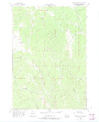
1956 Map of Medicine Mountain
USGS Topo · Published 1975About this map
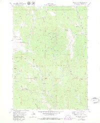
Gillette Prairie opens up across the high terrain of the Black Hills National Forest, revealing a mid-century landscape of remote ranching and early education. This 1956 survey traces the winding course of Slate Creek and its many tributaries, such as South Slate Creek and Gooseberry Draw, which carve through the dense timber of the Black Hills. Evidence of rural community life is found at the South Slate Sch and the settlement of Tigerville, while the Chicago Burlington and Quincy railroad follows the narrow valley of Newton Fork. The topography is dominated by local landmarks like Medicine Mountain, near the Medicine Mtn Ranch, and Copper Mountain. Long-established routes like Six Mile Road provide access through the gulches and draws, including Bobcat Gulch and Reno Gulch, documenting a period when these upland prairies were actively worked by local families.
Find a feature on this map
25 named features on this map. Tap any name to fly to it.
Don’t see what you’re looking for? This feature index may not catch every label — zoom into the map to look around manually.
Map Details
Editions of this 1956 Medicine Mountain Map
6 editions found
Other maps of this area

1894 · Deadwood
USGS Topo · 1:125,000

1896 · Harney Peak
USGS Topo · 1:125,000

1901 · Harney Peak
USGS Topo · 1:125,000

1901 · Deadwood
USGS Topo · 1:125,000

1916 · Deadwood
USGS Topo · 1:125,000

1953 · Rapid City
USGS Topo · 1:250,000

1954 · Silver City
USGS Topo · 1:24,000

1954 · Custer
USGS Topo · 1:24,000

1954 · Hill City
USGS Topo · 1:24,000

1954 · Berne
USGS Topo · 1:24,000