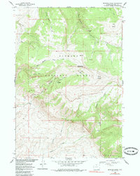
1960 Map of Medicine Wheel
USGS Topo · Published 1985About this map
Medicine Wheel (Archeological Site) stands as the centerpiece of this high-altitude landscape within the Bighorn National Forest, situated just north of Medicine Mountain. The terrain is defined by dramatic elevation changes, from the depths of Devil Canyon to the summits of Cone Mountain. This 1960 survey, field-checked during the development of the Missouri River Basin program, captures the area's transition from primitive access to recreational development. Evidence of this includes the Jeep Trail systems and Five Springs Campground near the Five Springs Basin. The hydrology of the region is mapped in detail, showing how seasonal flows from Railroad Springs Creek and Elk Springs Creek drain the plateau. Named local landmarks like Tillets Hole, Pete's Hole, and Long Park offer specific points of interest for those studying the regional geography and land usage of the mid-20th century Big Horn area.
Find a feature on this map
24 named features on this map. Tap any name to fly to it.
Don’t see what you’re looking for? This feature index may not catch every label — zoom into the map to look around manually.
Map Details
Editions of this 1960 Medicine Wheel Map
3 editions found
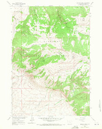
Other maps of this area

1898 · Bald Mountain
USGS Topo · 1:125,000

1901 · Bald Mountain
USGS Topo · 1:125,000

1955 · Cody
USGS Topo · 1:250,000

1955 · Sheridan
USGS Topo · 1:250,000

1958 · Cody
USGS Topo · 1:250,000

1958 · Sheridan
USGS Topo · 1:250,000

1960 · Medicine Wheel
USGS Topo · 1:24,000

1960 · Boyd Ridge
USGS Topo · 1:24,000

1960 · Mexican Hill
USGS Topo · 1:24,000

1960 · Bear Creek Ranch
USGS Topo · 1:24,000