
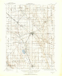
1904 Map of Medina
USGS Topo · Published 1954About this map
Medina serves as the focal point for this early twentieth-century survey of the Ohio landscape, appearing at a time when traditional pikes and burgeoning rail lines dictated the regional flow of commerce. The map illustrates the convergence of several major transportation routes, including the Northern Ohio R R and the Baltimore and Ohio R R (Lorain Br), which connected smaller hubs like Liverpool Sta and Lester.
Find a feature on this map
57 named features on this map. Tap any name to fly to it.
Don’t see what you’re looking for? This feature index may not catch every label — zoom into the map to look around manually.
Map Details
Editions of this 1904 Medina Map
2 editions found
Other maps of this area

1901 · Oberlin
USGS Topo · 1:62,500

1901 · Massillon
USGS Topo · 1:62,500

1901 · Wooster
USGS Topo · 1:62,500

1902 · Berea
USGS Topo · 1:62,500

1903 · Massillon
USGS Topo · 1:62,500

1903 · Wooster
USGS Topo · 1:62,500

1903 · Cleveland
USGS Topo · 1:62,500

1903 · Oberlin
USGS Topo · 1:62,500

1903 · Akron
USGS Topo · 1:62,500

1904 · Berea
USGS Topo · 1:62,500