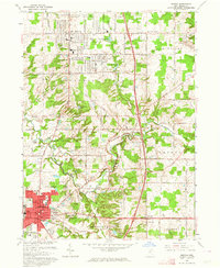
1963 Map of Medina
USGS Topo · Published 1964About this map
Medina serves as a bustling hub of civic and residential growth in the early 1960s, with its Public Square and Courthouse anchoring a dense grid of streets including Washington St and Homestead St. The landscape to the north reflects the post-war expansion of Brunswick, where new developments like the Shopping Center and Applewood Sch appear alongside established landmarks like Lake Brunswick. This era of transition is visible in the suburban footprint pressing against the traditional agricultural landscape of Brunswick Hills and Granger.
Find a feature on this map
55 named features on this map. Tap any name to fly to it.
Don’t see what you’re looking for? This feature index may not catch every label — zoom into the map to look around manually.
Map Details
Editions of this 1963 Medina Map
2 editions found
Other maps of this area

1902 · Berea
USGS Topo · 1:62,500

1903 · Cleveland
USGS Topo · 1:62,500

1903 · Akron
USGS Topo · 1:62,500

1904 · Berea
USGS Topo · 1:62,500

1904 · Medina
USGS Topo · 1:62,500

1905 · Akron
USGS Topo · 1:62,500

1906 · Medina
USGS Topo · 1:62,500

1950 · Cleveland
USGS Topo · 1:250,000

1953 · West View
USGS Topo · 1:24,000

1953 · Broadview Heights
USGS Topo · 1:24,000