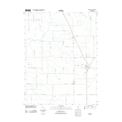
2012 Map of Medora
USGS Topo · Published 2012About this map
Medora anchors the southeastern portion of this Macoupin County landscape, where the agricultural grid is defined by a dense network of country roads and small family-named landmarks. The terrain is shaped by the meandering course of Macoupin Cr and its tributaries, including Phils Cr, which cut through the farm plots. Smaller settlements like Kemper and Fidelity serve as local hubs, connected by routes such as Kemper Rd and S Appletrees Rd. For genealogists, the map is particularly detailed regarding burial sites, documenting numerous small grounds like Pruitt Cem, Longwill Cem, and Moore Cem. These scattered cemeteries, often situated near original homesteads or along quiet lanes like Schoolhouse Ln, provide a clear view of the area's rural social geography in the early 21st century.
Find a feature on this map
64 named features on this map. Tap any name to fly to it.
Don’t see what you’re looking for? This feature index may not catch every label — zoom into the map to look around manually.
Map Details
Editions of this 2012 Medora Map
This is the sole edition of this map. No revisions or reprints were ever made.
Other maps of this area

1924 · Roodhouse
USGS Topo · 1:62,500

1925 · Brighton
USGS Topo · 1:62,500

1926 · Roodhouse
USGS Topo · 1:62,500

1928 · Brighton
USGS Topo · 1:62,500

1930 · Jerseyville
USGS Topo · 1:62,500

1932 · Greenfield
USGS Topo · 1:62,500

1933 · Jerseyville
USGS Topo · 1:62,500

1948 · Quincy
USGS Topo · 1:250,000

1956 · Quincy
USGS Topo · 1:250,000
1982 · Summerville
USGS Topo · 1:24,000